My FAQs page is the best place to start if you want to learn general info about this area.
Here is a map showing an overview of the Seligman Area Ranch Developments
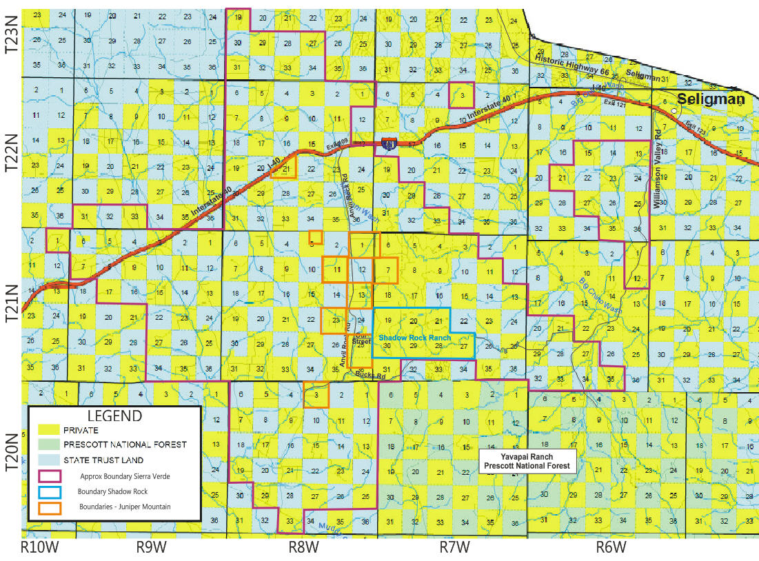
The map above shows the three major developments in the area:
- Juniper Mountain Ranches – Located on each side of Anvil Rock Road, Outlined in Orange
- Shadow Rock Ranch – East of Anvil Rock Rd. Primary Access is via Our Street, Outlined in Blue
- Sierra Verde Ranch – Surrounding the other two developments, Outlined in Red
All three of these developments were made by the Double O Ranch belonging to Seibert Land Company.
Their cattle range throughout this area as it is Open Range here. That means cattle will come onto
your property unless you fence them out. There are also Exception properties that were not sold but retained by Seibert.
These are generally places with stock tanks or waterholes for the cattle.
Notice the checkerboard pattern on this map.
Get an explanation of the checkerboard pattern of land use here.
The blue and green sections on this map are GOVERNMENT (Prescott National Forest) or Arizona State Trust land.
Learn more about the Arizona State Trust Land.
If you are trying to locate a specific lot, use our lot search page to get coordinates or parcel numbers.